Block Island

Raymarine and CMOR help Anglers, Divers Discover More
The best diving and bottom-fishing spots are the ones that don’t show up on paper or digital charts and aren’t marked on commercially available fishing maps. They’re the forgotten wrecks, the isolated reefs, the ledges hidden between the contour lines — the kinds of places that take hundreds of hours on the water and countless dollars in fuel to find.CMOR Mapping’s chartplotter-compatible bathymetry clearly reveals those spots. With resolution as high as one meter (each pixel represents a single square meter of bottom) and coverage of the entire bottom…

Yacht Sinks after Crash with a Lobster Boat
A yacht and a commercial fishing vessel collided Tuesday about 10 miles east of Block Island, Rhode Island. No injuries have been reported. The 40-foot lobster boat, Squeeze Play, manned by a two-man crew, was struck by the yacht Lucia, which had four people aboard. The yacht was reported to be sinking after suffering a hole in its bow. Squeeze Play’s crew then helped the four people transfer from Lucia to their lobster boat. The U.S. Coast Guard launched a 45-foot response boat crew as well as a MH-60 Jayhawk air crew to assist on scene.

Yacht Rescue Involves Cutter in Long Tow
The Coast Guard cutter 'Block Island' has completed a 150 miles tow over a 32-hour period of the disabled 54-foot yacht 'Zulu' with 3 persons on board during bad weather off the coast of North Carolina. The captain aboard the Zulu initially contacted Coast Guard Sector North Carolina watch-standers via satellite phone to report that the sailboat was disabled and adrift with three people aboard approximately 100 miles east of Oregon Inlet, N.C. In early course the Coast Guard Cutter Block Island arrived on scene…

NV Charts Debuts New Northeast Regional Chart
One of the most popular boating and cruising areas on the U.S. East Coast, the region from Long Island, New York to Nantucket, is now available in improved format and readability from NV Charts. Region 3.1: Rhode Island to Nantucket Sound, including the waters from Watch Hill, R.I. to Chatham, Mass., on the lower end of Cape Cod, includes Nantucket, the Elizabeth Islands and Buzzard’s Bay, Block Island, Block Island Sound and all of Narragansett Bay. The nv charts Region 3.1 set is provided in paper and digital format for sailors…

McConaghy Boats at Strictly Sail Pacific Boat Show
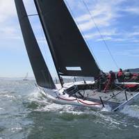
Following on from McConaghy Boats dominating their classes at the Quantum Key west race week their MC38 is on show in Oakland, Calif. The show runs from April 11-14, 2013 and Don Payan's MC38 "Whiplash" will be on display, and Naval Architect Harry Dunning will also be in town from Newport R.I. joined by McConaghy's Ellen Pragnell-Rasch from Sydney for the duration of the show. Quantum Key West race week results showed again that McConaghy built yachts are a force to be reckoned with.
