Northport Systems Inc

Fugawi Announces $10 NV Digital Charts
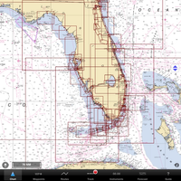
Online chart service Fugawi X-Traverse, has announced new pricing for NV Digital Charts. Designed for use with the iNavX iOS app, NV charts of the United States East Coast and the Caribbean are now available for download for as little as $9.95. Fugawi X-Traverse delivers value to iNavX users by offering a fantastic navigational package with NV Charts. iNavX has sets of boating features including trip planning, navigation and NMEA compatibility, and provides access to online chart catalog through Fugawi X-Traverse.

MarineFuel.com Offers New Service Options
MarineFuel.com, LLC launched a new Membership Menu to create Premium Data and Services options customized to serve the boater seeking less than 1,000 gallons of boat gas or marine diesel while on the water. Access to the Marinas Directory is always free, but (free - no credit card required) Registration is necessary to unlock the Fuel Locator and Marina Finder full search results, and short-term Premium Memberships are available for those who enjoy the time and money saving tools of advanced database filtering features.

Northport Systems' Fugawi Marine 5 Navigation Software Shipping
Newly Designed Navigation Software Offers Streamlined Way to Manage Boat Navigation Systems. Software manufacturer Northport Systems Inc. has announced the availability of its next-generation, streamlined marine navigation software, Fugawi Marine 5. Completely redesigned from the ground up to make it easier for sailors, power boaters and anglers to manage their boat’s navigation systems to better suit their needs and have more fun on the water, Fugawi Marine 5 revolutionizes navigation, waypoint management and chart downloading.

Wavey Line Charts for Bahamas, Turks & Caicos, DR
Leading Online Map Service Now Offers the Most Detailed Cartography of Bahamian and Northern Caribbean Waters. Software manufacturer Northport Systems Inc. announced today that its popular Fugawi X-Traverse online map collection now supports Wavey Line high definition raster charts of the Bahamas, Turks & Caicos, and the north coast of the Dominican Republic. Providing mariners with access to the most accurate and up-to-date charts available for the northern Caribbean waters,…
