Navigation Software

Raytheon Anschütz INS for Ritz-Carlton Yacht Collection
The Ritz-Carlton Yacht Collection, together with the Spanish Barreras shipyard of Vigo, have selected Raytheon Anschütz to supply a high-end Integrated Navigation System (INS) of the Synapsis NX generation for the first vessel of a new class of most advanced passenger ships.The INS is part of a larger contract awarded to ABB’s Marine and Ports Business, who are acting as the total ship system provider and integrator to the new class of ships. ABB and Raytheon Anschütz have entered…
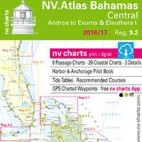
nv Charts Updates Florida, Bahamas, Caribbean Charts
nv charts has announced the release of their newly updated chart sets for Florida, the Bahamas and the Caribbean for 2016/17 in paper and digital format. In addition to being updated, the new NV.Atlas format brings a modern, handy design to the charts that’s practical and easy to use. The chart set includes a download of digital charts, including free navigation software, plus the free nv charts Mobile App for iOS and Android mobile devices. The App includes free digital updates for this chart set for 2016/17.

Up-to-date Cuba Atlas Charts Released
Press release - American cruisers, sailors, and boaters wanting to visit Cuba can now travel in confidence using new and updated chart sets for the entire Cuban coastline. NV Charts has announced the release of all four (4) Cuba chart sets in NV Charts’ new and popular Atlas style format. “Recently, the U.S. Government issued new rules regarding travel to Cuba,” states Hasko Scheidt, NV Charts’ CEO. “This is a momentous step forward for the boating industry, because now, persons travelling to Cuba can sail there on their own vessels, and with others.
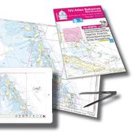
New Format for Bahamas Chart Sets
NV Charts has announced the release of all chart sets, beginning with its Bahamas chart sets, in new Atlas style format. The new format applies to its newly updated chart sets for Region 9.1, Bahamas Northwest, including Bimini and Berry Islands, Nassau to Abaco, and Grand Bahama, for 2015/2016. All of the NV Charts Bahamas sets will shortly be available in Atlas format, check the website, www.nvcharts.com, for availability. “Atlas format is handy, compact, and easy to use and manage,” states Hasko Scheidt, CEO.
Seapilot Navigation App Available for Windows Mobile Devices
True Heading announced the release of its Seapilot Navigation app for Windows mobile devices today. The Seapilot Navigation app had previously been available for Apple and Android devices. The app is now available for free download on the Windows Phone Store. Early Windows Store reviews, however, indicate required in-app purchases. The product's fine print indicates a free 36-hour trail period "with all functionality and all charts available for evaluation before purchase." Users also complained about a lack of maps for US coastal waters. The app displays S-57 vector chart data on its proprietary chart engine.
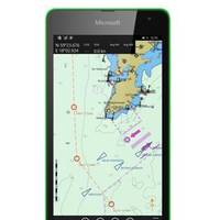
Seapilot Navigation App Released
Seapilot has released its navigation app for Windows mobile devices. Continuing its focus on mobility, the Seapilot Navigation app, originally available on Apple and Android devices, is now available for free from the Windows Phone Store. The Seapilot Navigation app displays S-57 vector chart data on its proprietary chart engine. When used with a direct GPS connection, the app shows position and presents up-to-the-minute AIS data on most portable devices. The Seapilot app is capable of displaying current position information…

KEP Announces Partnership with NSI
Kessler-Ellis Products (KEP) announced that it has been selected as the exclusive Americas distributor of NSI input devices. Effective immediately, KEP will sell and support the full line of premier keyboards and trackballs for both recreational and commercial marine markets. With NSI from KEP, boaters are assured they have the highest quality marine input solutions for relaible and efficient operation. Designed to provide unprecedented control and accuracy, NSI marine keyboards and trackballs are purpose-built to meet the tough demands of the saltwater environment.
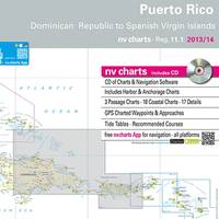
nv charts Update Puerto Rico Charts for 2014
nv charts announces the release of their newly updated chart set for Region 11.1, Puerto Rico, updated and meticulously surveyed and now available just in time for cruising the Caribbean Sea during the winter months. The set includes the north coast of the Dominican Republic , and is available in a variety of formats – paper, digital, memory cards for chartplotters, and with nv charts’ new iOS App for navigation with mobile devices. nv charts’ Region 11.1 is provided in paper and digital format for sailors, motor boaters, fishermen and professional mariners, and cruising enthusiasts.

Northport Systems' Fugawi Marine 5 Navigation Software Shipping
Newly Designed Navigation Software Offers Streamlined Way to Manage Boat Navigation Systems. Software manufacturer Northport Systems Inc. has announced the availability of its next-generation, streamlined marine navigation software, Fugawi Marine 5. Completely redesigned from the ground up to make it easier for sailors, power boaters and anglers to manage their boat’s navigation systems to better suit their needs and have more fun on the water, Fugawi Marine 5 revolutionizes navigation, waypoint management and chart downloading.

Wavey Line Charts for Bahamas, Turks & Caicos, DR
Leading Online Map Service Now Offers the Most Detailed Cartography of Bahamian and Northern Caribbean Waters. Software manufacturer Northport Systems Inc. announced today that its popular Fugawi X-Traverse online map collection now supports Wavey Line high definition raster charts of the Bahamas, Turks & Caicos, and the north coast of the Dominican Republic. Providing mariners with access to the most accurate and up-to-date charts available for the northern Caribbean waters,…
